What Is a Map Projection?
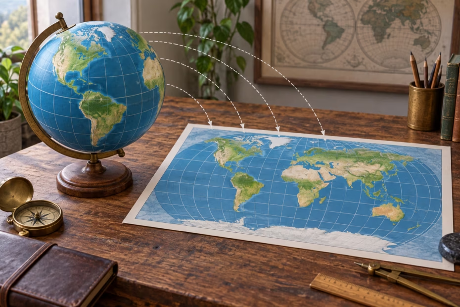
A map projection is a method for representing Earth’s curved surface on a flat map or screen. In a sentence, the phrase is usually a countable noun: a map projection, the map projection, or different map projections. For example: “The atlas uses a map projection that balances the appearance of continents on a world map.” A projection is the method used to transform geographic locations; the map is the finished representation.
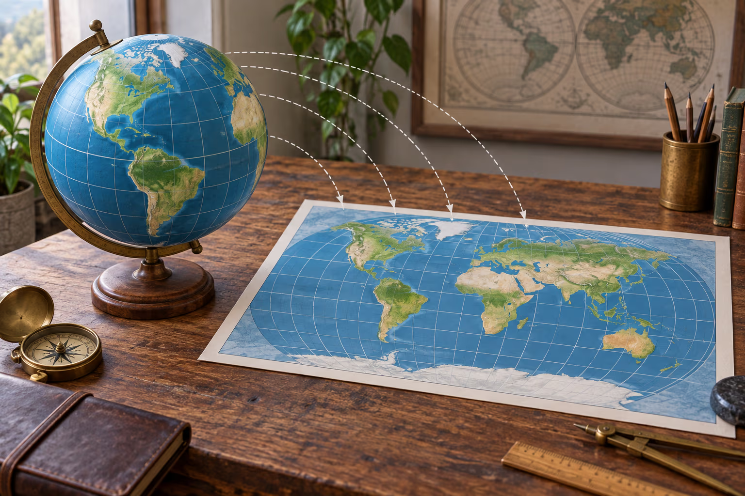
Because a sphere cannot be flattened without stretching, tearing, or compressing it, every flat map distorts at least one property. Depending on the projection and the part of Earth shown, the map may change area, shape, distance, direction, or scale. The U.S. Geological Survey explains that a projection can preserve one or more useful properties, but a flat map cannot preserve them all everywhere (USGS overview of map projections).
Map Projection Examples in Sentences
- “The geographer selected a map projection that preserves area for the population-density comparison.”
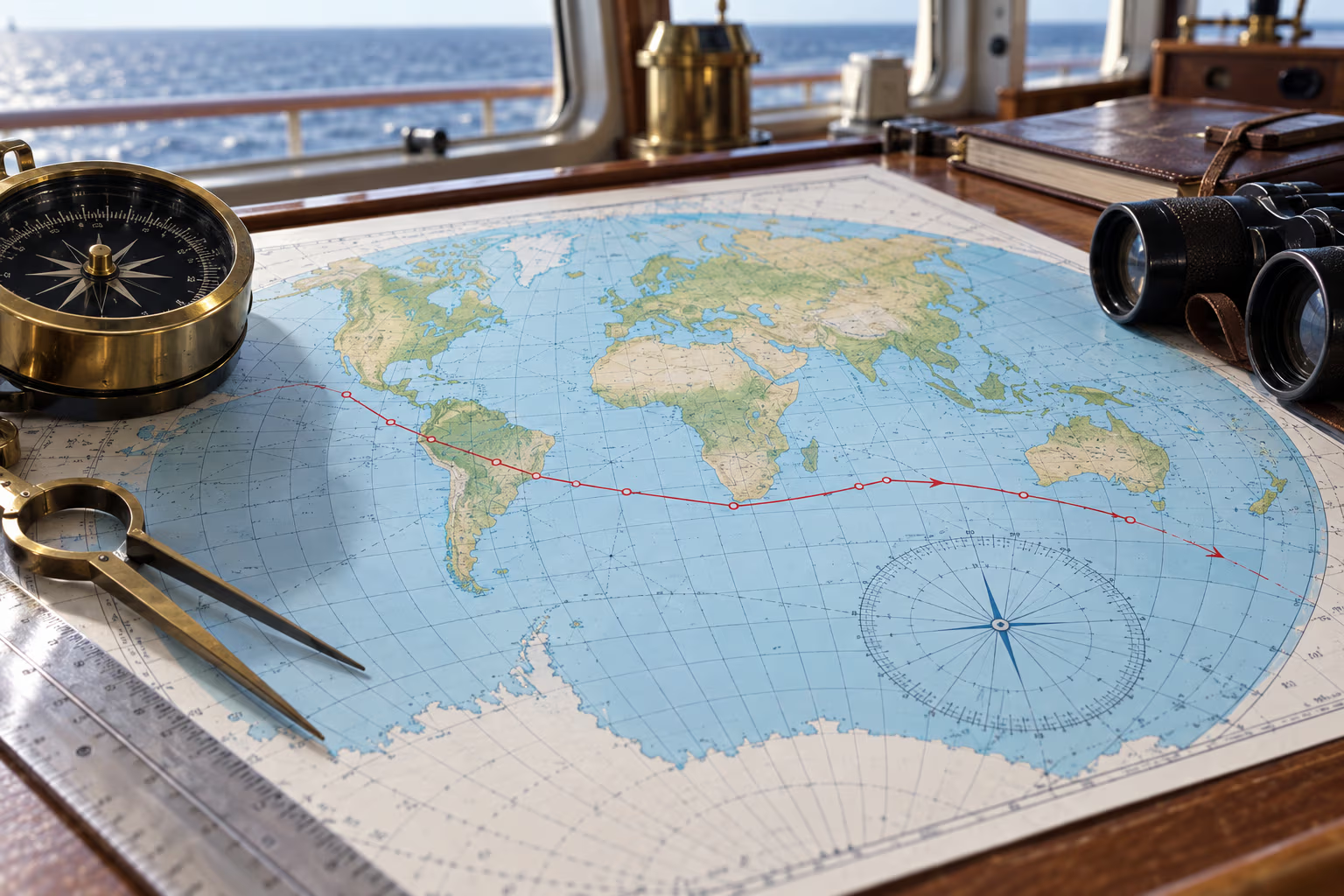
- “Our navigation chart uses the Mercator projection, so constant compass bearings appear as straight lines.”
- “The class compared two map projections and noticed how the continents changed shape.”
- “A local map projection can reduce distortion across the region being surveyed.”
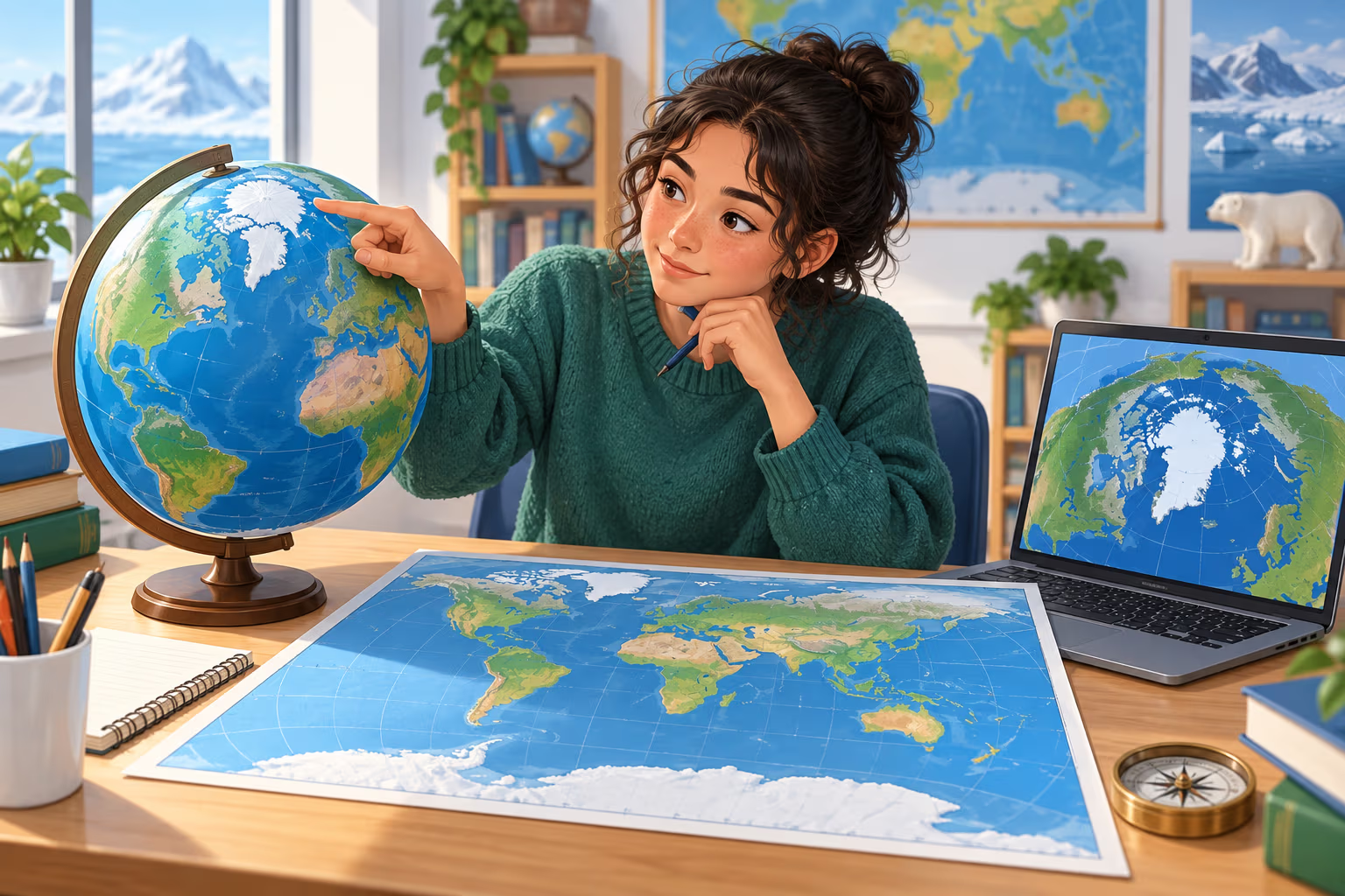
- “The map’s projection makes Greenland look much larger than it does on an equal-area map.”
- “Before measuring land area, check which map projection the GIS layer uses.”
Common verbs and phrases include choose a map projection, use a projection, compare projections, project geographic data, and switch or change the projection. The plural map projections is used when discussing multiple methods or comparing their effects.
How Projections Trade Area, Shape, Distance, and Direction
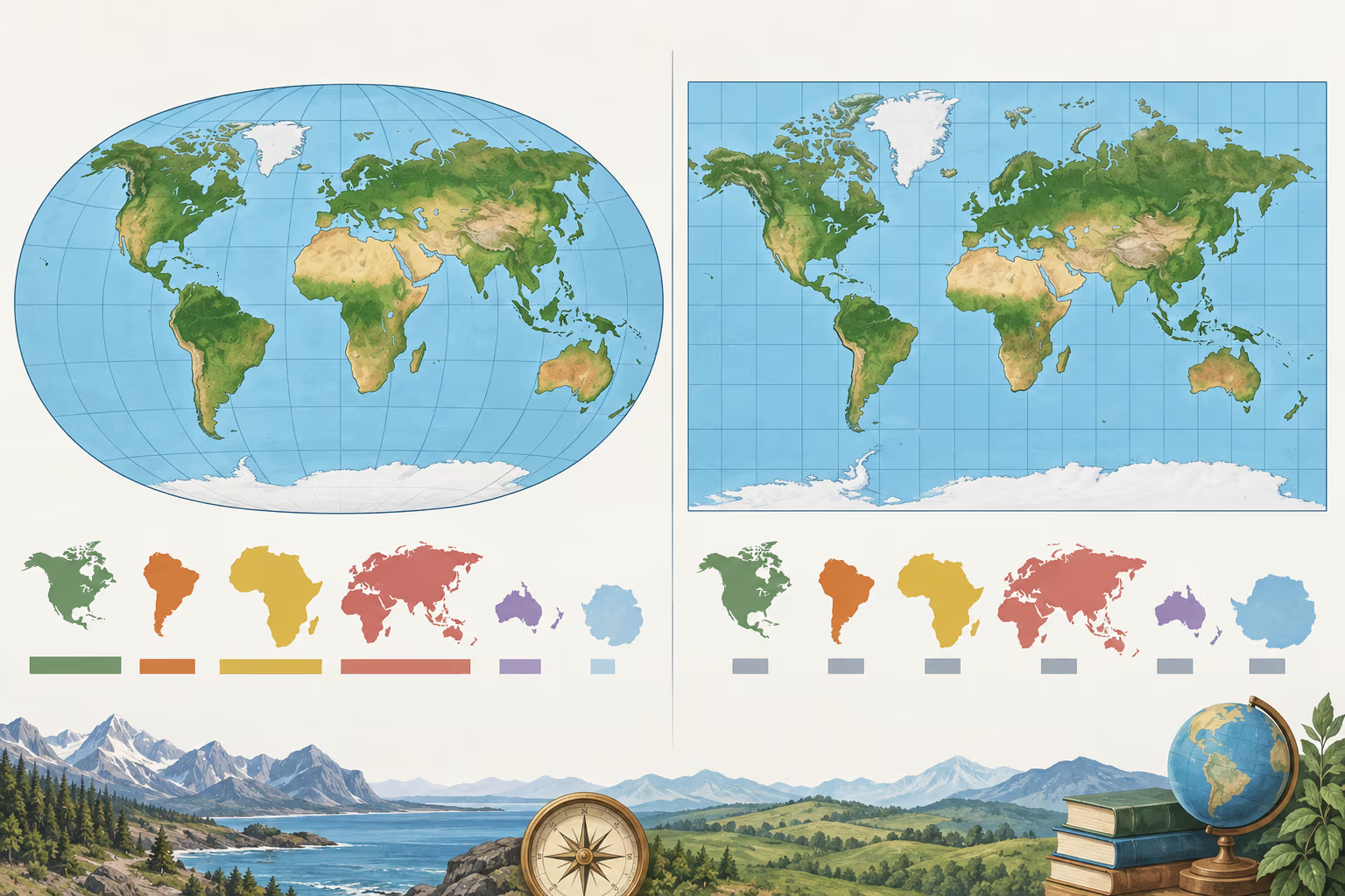
Projection names often signal which property the map is designed to preserve, and over what part of the map:
- Mercator: a conformal projection that preserves local angles and shows constant compass bearings as straight lines, which can help with navigation. It does not preserve area; land near the poles appears greatly enlarged, and distance scale also changes with latitude. It is inaccurate to say that Mercator preserves all shapes everywhere: small local shapes are represented well, while shapes and sizes of large regions are distorted.
- Equal-area projections: preserve relative area, useful when comparing the size of regions or mapping distributions. They distort local shapes to achieve this property. The Albers Equal Area Conic is one example used for regional and continental maps.
- Equidistant projections: preserve true distance only along particular lines or from selected points, depending on the projection. “Equidistant” does not mean every pair of places is shown at its true distance.
- Compromise projections: such as Robinson, balance several kinds of distortion for a visually balanced world map, rather than perfectly preserving one property such as area or distance.
These distinctions matter in the sentence: “The equal-area projection makes the country’s area comparison fairer” describes a benefit, while “The same projection distorts the shape of some regions” explains the trade-off. Projection choice depends on the map’s purpose, geographic extent, and the measurement or visual comparison a reader needs. USGS and Esri both emphasize choosing the projection for the region and the property that matters (USGS projection guide; Esri coordinate-system guidance).
How to Use “Map Projection” Naturally
The phrase names a cartographic method, so it fits naturally in geography, navigation, mapping, and GIS contexts. It does not mean the map’s topic or viewpoint; it refers to the mathematical way locations on a curved body are represented on a plane. Useful sentence frames include:
- “This map uses the [name] projection to…” — “This map uses the Robinson projection to present a balanced view of the whole world.”
- “Choose a map projection based on…” — “Choose a map projection based on the region and the data you need to compare.”
- “The projection distorts [property] near…” — “The projection distorts area near the poles.”
- “The data were reprojected from [one system] to [another].” — In GIS writing, this describes converting coordinates so data align with a different projected coordinate system.
Frequently Asked Questions
Is “map projection” one word or two?
It is written as two words: map projection. Use map projections for the plural.
Can a map projection preserve every property?
No. Every flat map of a curved surface involves distortion. A projection can preserve one or more properties for particular locations or purposes, but not area, shape, distance, and direction everywhere at once.
Does the Mercator projection preserve shape?
Mercator is conformal, which means it preserves local angles and small shapes. It does not preserve the areas or overall shapes of large regions; distortion becomes much greater toward the poles.
What is the difference between a map and a map projection?
A map is the representation a reader sees. A map projection is the method used to place locations from Earth’s curved surface onto that flat representation.
Have you ever wondered how maps can accurately represent the spherical surface of the Earth on a flat piece of paper? This is where map projections come into play. Map projection is the process of depicting a three-dimensional surface onto a two-dimensional plane, allowing us to navigate and understand the world around us.
Map projections can introduce distortions in size, shape, distance, or direction due to the challenge of representing a curved surface on a flat map. Different map projections are used for various purposes, each with its own strengths and weaknesses. Understanding map projections is crucial for accurate interpretation and analysis of geographic data.
7 Examples Of Map Projection Used In a Sentence For Kids
- A map projection helps to show the Earth on a flat piece of paper.
- There are many different types of map projections that show the world in different ways.
- A map projection can help us understand where places are on a map.
- Map projections can show us how big or small places are on a map.
- We use map projections to help us navigate and find our way around.
- It is important to choose the right map projection depending on what we want to show on the map.
- A map projection can help us to see the world from different perspectives.
14 Sentences with Map Projection Examples
- Map projection is a crucial concept for geography students to understand how the Earth’s three-dimensional surface is represented on a two-dimensional map.
- College students in India often use different types of map projections in their geography classes to study the distribution of various features.
- Understanding the distortion that occurs in different map projections can help students interpret maps accurately.
- When working on geography assignments, students frequently have to choose the most suitable map projection for their research purposes.
- Learning about different map projections can be challenging, but it is essential for students pursuing a degree in geography.
- Map projections play a significant role in helping students visualize and analyze spatial data effectively.
- In cartography classes, students learn about the advantages and limitations of various map projections.
- College students often conduct research projects that involve comparing the accuracy of different map projections for specific regions.
- By understanding the principles of map projection, students can create visually appealing and accurate maps for presentations.
- Knowledge of map projections allows students to recognize how distortions can affect the interpretation of geographic information.
- In advanced geography courses, students explore the mathematical formulas behind different map projection techniques.
- College students studying remote sensing often apply concepts of map projection to analyze satellite imagery.
- Understanding the concept of map projection is crucial for students completing fieldwork assignments in diverse geographical locations.
- By experimenting with various map projections, students can develop a better understanding of how different regions are represented on maps.
How To Use Map Projection in Sentences?
Map projection is the method used to represent the three-dimensional surface of the Earth on a two-dimensional map. To use map projection effectively, it is important to understand the purpose of the map and choose the appropriate projection that best fits the intended use.
When selecting a projection, consider factors such as the area of interest, the type of data being displayed, and the distortion that may occur. Different projections can maintain certain properties, such as preserving area, shape, distance, or direction. For example, the Mercator projection preserves angles and shapes but distorts size, making it useful for navigation charts, while the Peters projection preserves area but distorts shape.
To use map projection in a sentence, one can say “This map uses the Robinson projection to show a visually appealing representation of the world with minimal distortion.” By understanding the characteristics of different projections, users can create maps that accurately communicate geographical information.
Remember that no single projection can perfectly represent the Earth’s surface due to its curved nature. It is essential to choose a projection that minimizes distortion for the specific purpose of the map. With practice and experimentation, users can gain a better understanding of how map projection works and how to optimize it for various mapping tasks.
Conclusion
In conclusion, map projections are methods used to represent the three-dimensional surface of the Earth on a two-dimensional map. There are various types of map projections, each with its own strengths and weaknesses, leading to distortions in different aspects like distance, area, or direction. For example, the Mercator projection is commonly used for navigation due to its ability to preserve angles, while the Peters projection aims to accurately represent the relative sizes of landmasses.
Understanding map projections is essential for interpreting and using maps effectively as it impacts how we perceive the world and make spatial decisions. It is important to select the most suitable projection based on the specific purpose and location of the map to ensure accurate representation of features and distances on the Earth’s surface.